T • he theatre
of the globe
Jane Ridley
IMAGINED CORNERS by Paul Binding Review, £25, pp. 314, ISBN 0747230404 Atlases are things that one takes for granted, but they have an interesting history. This book tells the story of the world's first atlas, which was published in Antwerp in 1570. It was the brainchild of a Dutchman named Ortelius.
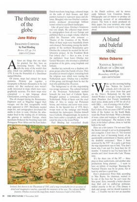
Of course, maps had existed for many centuries. Ptolemy put together a Geographia in Roman Alexandria in the 2nd century AD. But mediaeval men weren't really interested in maps which were topographically accurate. For them maps were conceptual — a sign language about Christendom, centring on Jerusalem. This all changed during the Renaissance. Explorers such as Magellan logged their voyages, and the first recognisable world map appeared in 1507. Merchants needed maps too, and cartographers developed the maths to draw to scale. Ortelius the atlasmaker lived in the trading city of Antwerp, the gateway to northern Europe, where merchants brokered the booming trade with Portuguese West Africa and the East Indies. Dutch merchants hung huge, coloured maps on the walls of their houses, and their painters learned to represent space and distance. Brueghel, who was Ortelius's contemporary, produced devastatingly brilliant scenes rooted in real Dutch landscapes. Like all good ideas, Ortelius's brainwave was very simple. He collected maps drawn by cartographers from all over Europe and published them as a single volume, which he called his Theatrum orbis terra rum — Theatre of the Countries of the World. Many of these maps were beautifully drawn and coloured. Networking among the intelligentsia of the northern Renaissance gave Ortelius the contacts he needed for his collaborative project. At the Frankfurt Book Fair (where else? — then as now, it was the publishers' bean feast) Ortelius met Gerard Mercator, who invented a cylindrical projection of the globe, using longitude and latitude.
Another key network was a shadowy religious group called the Family of Love. They preached an inward religion, retreating from the religious wars which were tearing the Netherlands apart. Ortelius was a member of this group, and through them he met the man who published his Theatrum. The background to all this map-making was savage repression. The cultural ferment of the Protestant Netherlands seethed beneath the iron heel of Catholic Spain. Brueghel painted a tormented, tortured Netherlands. Philip of Spain sent the cruel Duke of Alva to stamp out Protestant heresy, and violence and terror were everywhere. In the Spanish fury of 1576 Alva's troops went on the rampage and brutally murdered the Antwerpers. Ortelius himself was a Catholic. Disappointingly, he seems to have been rather a sycophant, and he dedicated his atlas to the tyrant Philip. Paul Binding has researched deeply in the Dutch archives, and he moves easily between Low Countries history, bibliography and art history to produce an illuminating account of an extraordinary project. The book is nicely produced on shiny paper; but your reviewer, who reads mainly on trains, found it very heavy to lug about.


 Previous page